


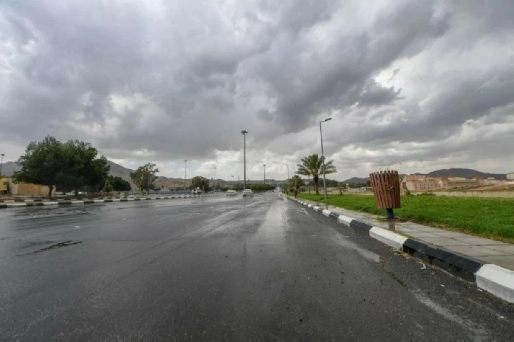
نبَّه المركز الوطني للأرصاد في تقرير له اليوم (الجمعة)، من هطول أمطار مصحوبة برياح نشطة، وتدنٍ في مدى الرؤية الأفقية، وصواعق رعدية، على عدد من محافظات منطقة مكة المكرمة، تشمل أضم والعرضيات والليث، مبيناً أن الحالة تستمر حتى الساعة الثامنة مساءً.
وكان المركز الوطني للارصاد توقّع في تقريره عن حالة الطقس، نشاطًا في الرياح السطحية المثيرة للأتربة والغبار التي تحد من مدى الرؤية الأفقية على أجزاء من مناطق تبوك، الجوف، الحدود الشمالية، حائل، المدينة المنورة، مكة المكرمة، والفرصة مهيأة لهطول أمطار رعدية خفيفة إلى متوسطة وتكون الضباب على أجزاء من تلك المناطق، وعلى أجزاء من مرتفعات منطقتي الباحة، عسير.
وأشار التقرير إلى أن حركة الرياح السطحية على البحر الأحمر شمالية غربية إلى غربية بسرعة 20-55 كم/ساعة على الجزء الشمالي، وجنوبية شرقية إلى جنوبية غربية بسرعة 10-35 كم/ساعة على الجزء الأوسط والجنوبي تصل إلى 50 كم/ساعة باتجاه مضيق باب المندب، وارتفاع الموج من متر إلى مترين يصل إلى أعلى من مترين ونصف على الجزء الشمالي، ومن نصف المتر إلى متر ونصف على الجزء الأوسط والجنوبي يصل إلى أعلى من مترين باتجاه مضيق باب المندب، وحالة البحر متوسط الموج إلى مائج على الجزء الشمالي، وخفيف إلى متوسط الموج على الجزء الأوسط والجنوبي يصل إلى مائج باتجاه مضيق باب المندب.
ووفقًا للمركز، ستكون حركة الرياح السطحية على الخليج العربي شمالية غربية بسرعة 10-25 كم/ساعة تتحول بعد الظهيرة إلى جنوبية شرقية بسرعة 18-38 كم/ساعة على الجزء الشمالي، وجنوبية شرقية إلى شمالية شرقية بسرعة 10-28 كم/ساعة على الجزء الأوسط والجنوبي، وارتفاع الموج من نصف المتر إلى متر ونصف على الجزء الشمالي، ومن نصف المتر إلى متر على الجزء الأوسط والجنوبي، وحالة البحر خفيف إلى متوسط الموج على الجزء الشمالي، وخفيف الموج على الجزء الأوسط والجنوبي.
The National Center of Meteorology warned in its report today (Friday) of rainfall accompanied by active winds, reduced horizontal visibility, and thunderstorms in several governorates of the Makkah region, including Adham, Al-Ardiyat, and Al-Lith, indicating that the condition will continue until 8 PM.
The National Center of Meteorology had predicted in its weather report active surface winds that stir up dust and sand, limiting horizontal visibility in parts of the regions of Tabuk, Al-Jawf, the Northern Borders, Hail, Medina, and Makkah, with a chance of light to moderate thunderstorms and fog in parts of those areas, as well as in parts of the highlands of the Al-Baha and Asir regions.
The report indicated that the surface wind movement over the Red Sea is northwesterly to westerly at a speed of 20-55 km/h in the northern part, and southeasterly to southwesterly at a speed of 10-35 km/h in the central and southern parts, reaching up to 50 km/h towards the Bab el-Mandeb Strait. The wave height ranges from one to two meters, exceeding two and a half meters in the northern part, and from half a meter to one and a half meters in the central and southern parts, reaching over two meters towards the Bab el-Mandeb Strait. The sea condition is moderate to rough in the northern part, and light to moderate in the central and southern parts, becoming rough towards the Bab el-Mandeb Strait.
According to the center, the surface wind movement over the Arabian Gulf will be northwesterly at a speed of 10-25 km/h, shifting after noon to southeasterly at a speed of 18-38 km/h in the northern part, and southeasterly to northeasterly at a speed of 10-28 km/h in the central and southern parts. The wave height will range from half a meter to one and a half meters in the northern part, and from half a meter to one meter in the central and southern parts, with the sea condition being light to moderate in the northern part, and light in the central and southern parts.


