


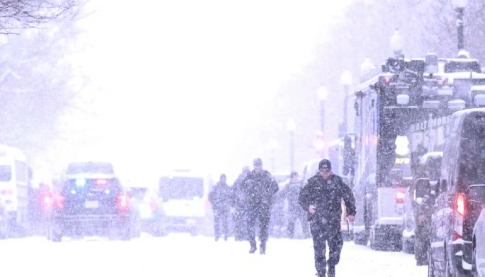
تستعد الولايات المتحدة الأمريكية، لعاصفة ثلجية كثيفة تُعد من أقوى موجات الشتاء هذا العام، وسط تحذيرات متصاعدة من خبراء الأرصاد الجوية بشأن الرياح العاتية والانخفاض الحاد في درجات الحرارة وتراكمات الثلوج التي قد تشلّ الحركة في عدد من الولايات. وتوقعت هيئة الأرصاد الوطنية الأمريكية، أن تشهد مناطق واسعة من ولايات مونتانا، داكوتا الشمالية، مينيسوتا، وميشيغان تساقطاً كثيفاً للثلوج يتجاوز 45 سنتيمتراً، مع سرعة رياح قد تصل إلى 80 كيلومتراً في الساعة خلال الأيام القادمة.
وتشير التوقعات إلى أن تأثير العاصفة سيمتد تدريجياً نحو ولايات الوسط الشرقي، ما يهدد بتعطيل الرحلات الجوية وإغلاق الطرق السريعة وانقطاع التيار الكهربائي عن آلاف المنازل. كما أصدرت السلطات المحلية تنبيهات عاجلة للسكان بضرورة تجنّب التنقل غير الضروري وتخزين المؤن الأساسية، تحسباً لانخفاض درجات الحرارة إلى ما دون 15 درجة مئوية تحت الصفر في بعض المناطق الشمالية. ويُرجّح أن تستمر العاصفة حتى نهاية الأسبوع، قبل أن تتراجع حدّتها تدريجياً، بينما أكدت خدمات الطوارئ جاهزيتها للتعامل مع أي حالات إجلاء أو إنقاذ محتملة.
ويرى خبراء المناخ أن العاصفة الحالية تمثل مؤشراً جديداً على اضطراب أنماط الطقس نتيجة التغير المناخي العالمي، الذي بات يضاعف من تكرار العواصف الثلجية العنيفة خلال فصل الشتاء في نصف الكرة الشمالي.
The United States is preparing for a heavy snowstorm, considered one of the strongest winter waves this year, amid escalating warnings from meteorologists about strong winds, a sharp drop in temperatures, and snow accumulations that could paralyze movement in several states. The National Weather Service has predicted that large areas of Montana, North Dakota, Minnesota, and Michigan will experience heavy snowfall exceeding 45 centimeters, with wind speeds reaching up to 80 kilometers per hour in the coming days.
Forecasts indicate that the storm’s impact will gradually extend towards the eastern central states, threatening to disrupt flights, close highways, and cause power outages for thousands of homes. Local authorities have issued urgent alerts to residents to avoid unnecessary travel and stockpile essential supplies in anticipation of temperatures dropping below 15 degrees Celsius below zero in some northern areas. The storm is expected to continue until the end of the week before gradually diminishing in intensity, while emergency services have confirmed their readiness to handle any potential evacuation or rescue situations.
Climate experts believe that the current storm represents a new indicator of disrupted weather patterns due to global climate change, which has been increasing the frequency of severe snowstorms during winter in the Northern Hemisphere.


 في المسجد الحرام وجاهزيته لاستقبال المصلين في رمضان")


